
Madeira by car: North and Central Tour
Touring: North & Central Madeira
This Northern and Central Madeira car tour takes you through a diverse range of landscapes and experiences, from the wild north coast (São Vicente, Boaventura, Santana) to the ancient forests of Ribeiro Frio and the high-altitude drama of Pico do Arieiro. The route balances coastal beauty, rural charm, and mountainous vistas, with cultural stops like Monte adding historical depth. Highlights include the volcanic caves of São Vicente, the traditional houses of Santana, the breathtaking views from Pico do Arieiro, and the serene gardens of Monte. The tour captures Madeira's rugged north, lush interior, and southern charm in a single, memorable day.
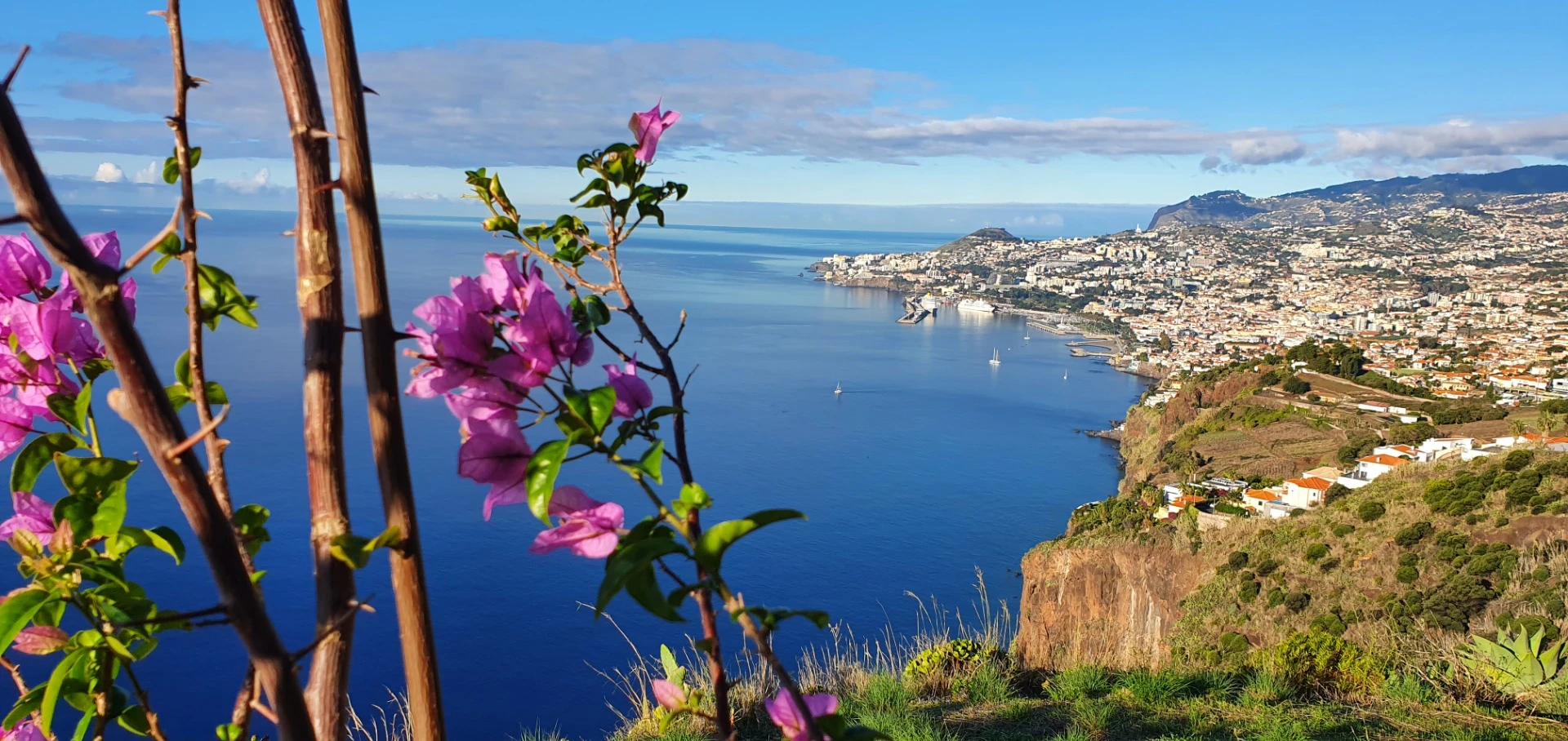
Starting Point: Funchal
Funchal, Madeira's vibrant capital on the south coast, is the perfect starting point. Before heading out, grab a coffee or a traditional pastel de nata at a café in the city center. Funchal's lively atmosphere, with its historical charm (like the Sé Cathedral) and oceanfront views, sets an exciting tone for the day. We'll return here to unwind at the end.
Total Distance: Approximately 120-130 km round trip, depending on exact routes.
Estimated Driving Time (without stops): Around 3-3.5 hours total.
Recommended Duration: 8-10 hours, including stops for sightseeing, photos, and a meal.
Leg 1: Funchal to Encumeada (Approx. 25 km, 40 minutes)
Route: From Funchal, take the ER103 northwest towards Ribeira Brava, then follow the VE1/VE3 north through the Encumeada Pass. The road climbs through lush valleys, offering early glimpses of Madeira's central mountains.
Stop: Encumeada
Encumeada Pass, at 1,007 meters above sea level, is a scenic mountain pass that marks the divide between Madeira's north and south coasts.
- Highlight: Miradouro da Encumeada. This viewpoint offers panoramic views of both the northern and southern coasts on clear days, with the Ribeira Brava Valley to the south and the northern peaks ahead. The surrounding peaks, often shrouded in mist, create a mystical atmosphere.
- Commentary: Encumeada is a gateway to Madeira's wild interior, offering a taste of the island's dramatic topography. The viewpoint is a great spot to stretch your legs and take in the contrast between the greener south and the rugged north. It's also a popular starting point for hikers tackling trails like the Vereda da Encumeada (PR12).
- Time to Spend: 20-30 minutes.
Leg 2: Encumeada to São Vicente (Approx. 15 km, 30 minutes)
Route: Continue on the VE3, descending towards São Vicente on the north coast. The road winds through forested slopes, with occasional views of the ocean as you approach the coast.
Stop: São Vicente
São Vicente, a picturesque town on the northern coast, is nestled between steep cliffs and the Atlantic, known for its volcanic caves and natural beauty.
- Highlight 1: São Vicente Caves (Grutas de São Vicente). These lava tubes, formed 890,000 years ago, offer a guided tour with a multimedia presentation on Madeira's geological history. The underground chambers are illuminated, showcasing the island's volcanic origins.
- Highlight 2: Coastal Promenade. Walk along the seafront to admire the dramatic cliffs and crashing waves. The town's setting, framed by green hills, is stunning.
- Highlight 3: Capelinha de São Vicente. This small cliffside chapel offers panoramic views of the north coast—a perfect photo spot.
- Commentary: São Vicente captures the untamed beauty of Madeira's north coast. The caves are a fascinating dive into the island's volcanic past, while the coastal scenery highlights the raw power of the Atlantic. The town's serene vibe makes it a refreshing stop, with the chapel adding a touch of charm.
- Time to Spend: 1-1.5 hours (including the cave tour).

Leg 3: São Vicente to Boaventura (Approx. 10 km, 20 minutes)
Route: Take the ER101 east towards Boaventura. This scenic coastal road hugs the cliffs, offering views of the ocean and passing through small tunnels carved into the rock.
Stop: Boaventura
Boaventura, a small village on the north coast, is known for its lush surroundings and peaceful atmosphere.
- Highlight 1: Miradouro de Boaventura. This viewpoint offers stunning views of the coastline, with the village's terraced fields and the ocean below. On clear days, you can see as far as São Vicente and Porto Moniz.
- Highlight 2: Local Agriculture. Boaventura is known for its fruit production, particularly bananas and grapes. If you spot a roadside stall, try some fresh produce or local wine.
- Commentary: Boaventura feels like a hidden gem, with its quiet rural charm and dramatic setting. The viewpoint showcases the north coast's rugged beauty, while the agricultural focus reflects the region's traditions. It's a brief but rewarding stop to soak in the island's slower pace of life.
- Time to Spend: 20-30 minutes.
Leg 4: Boaventura to Santana (Approx. 15 km, 30 minutes)
Route: Continue on the ER101 east towards Santana. The road remains scenic, with steep cliffs on one side and the ocean on the other, passing through small villages like Arco de São Jorge.
Stop: Santana
Santana, on the northeast coast, is famous for its traditional thatched houses and natural attractions.
- Highlight 1: Traditional Houses (Casas Típicas). These triangular, thatched-roof houses, painted in bright colors, are iconic symbols of Madeira. Many are preserved at the Santana Theme Park, where you can learn about their history and construction.
- Highlight 2: Miradouro da Rocha do Navio. A short drive from the town center, this viewpoint overlooks the Rocha do Navio Nature Reserve, with its dramatic cliffs, sea stacks, and a waterfall cascading into the ocean. A cable car or trail leads down to the fajã (coastal platform) below if you're up for a detour.
- Commentary: Santana offers a glimpse into Madeira's cultural heritage with its traditional houses, which were once common across the island. The Rocha do Navio viewpoint is a highlight, showcasing the northeast coast's wild beauty and biodiversity—it's a protected area known for its marine life and rare plants. Santana is also a good spot for lunch; try a local dish like milho frito (fried cornmeal) at a nearby restaurant.
- Time to Spend: 1-1.5 hours (including lunch).

Leg 5: Santana to Ribeiro Frio (Approx. 15 km, 30 minutes)
Route: Head south on the ER103 towards Ribeiro Frio. The road climbs into the island's interior, passing through dense laurel forests (part of the UNESCO-listed Laurisilva Forest).
Stop: Ribeiro Frio
Ribeiro Frio, a small hamlet in the central mountains, is a gateway to Madeira's ancient forests and hiking trails.
- Highlight 1: Balcões Viewpoint (Miradouro dos Balcões). A short, easy walk (1.5 km round trip) through the forest leads to this viewpoint, offering breathtaking views of the central peaks, including Pico do Arieiro and Pico Ruivo, with the Ribeira da Metade valley below. On clear days, you can see the Penha d'Águia rock on the coast.
- Highlight 2: Trout Farm. Ribeiro Frio is known for its trout farming—small ponds along the stream breed trout, which you'll often find on local menus.
- Commentary: Ribeiro Frio immerses you in Madeira's pristine nature. The Balcões trail is a must-do, with its rewarding views and serene forest setting—keep an eye out for endemic birds like the Madeira firecrest. The trout farm adds a quirky touch, reflecting the area's sustainable traditions. The cool, misty air here is a refreshing change after the coastal stops.
- Time to Spend: 45 minutes to 1 hour.

Leg 6: Ribeiro Frio to Poiso (Approx. 5 km, 15 minutes)
Route: Continue south on the ER103 towards Poiso. The road remains forested, with the landscape opening up as you gain altitude.
Stop: Poiso
Poiso, at 1,400 meters above sea level, is a high-altitude pass and a junction point for accessing Pico do Arieiro.
- Highlight: Casa de Abrigo do Poiso. This traditional mountain shelter offers a cozy spot to grab a hot drink or snack, like a bowl of tomato and onion soup (sopa de tomate e cebola) or a poncha. The surrounding area offers views of the central peaks.
- Commentary: Poiso is a brief but atmospheric stop, with its crisp mountain air and rustic charm. It's a practical base for hikers heading to Pico do Arieiro or Pico Ruivo, but even a quick pause here lets you appreciate the high-altitude serenity and the transition from forest to alpine landscapes.
- Time to Spend: 15-20 minutes.
Leg 7: Poiso to Pico do Arieiro (Approx. 7 km, 15 minutes)
Route: From Poiso, follow the ER103 west towards Pico do Arieiro. The road climbs to 1,818 meters, offering increasingly dramatic views.
Stop: Pico do Arieiro
Pico do Arieiro, Madeira's third-highest peak at 1,818 meters, is one of the island's most iconic viewpoints.
- Highlight: Miradouro do Pico do Arieiro. The viewpoint offers jaw-dropping 360-degree views of Madeira's central mountains, with rugged peaks, deep valleys, and often a sea of clouds below. On clear days, you can see Pico Ruivo and even the south coast.
- Commentary: Pico do Arieiro feels otherworldly, with its stark, rocky landscape and sweeping vistas. It's a highlight of the tour, showcasing Madeira's high-altitude drama—sunrise or sunset visits are particularly magical if you can time it right. The air is chilly, and clouds can roll in quickly, adding to the mystical vibe.
- Time to Spend: 30-45 minutes.
Leg 8: Pico do Arieiro to Monte (Approx. 15 km, 30 minutes)
Route: Head back to Poiso, then take the ER103 south towards Monte, a suburb of Funchal. The road descends through forests and residential areas.
Stop: Monte
Monte, perched above Funchal at around 550 meters, is known for its historical sites and lush gardens.
- Highlight 1: Monte Palace Tropical Garden. This stunning garden features exotic plants, koi ponds, and oriental-inspired architecture, with views over Funchal and the ocean.
- Highlight 2: Igreja de Nossa Senhora do Monte. This 18th-century church is a pilgrimage site, with a beautiful interior and a terrace offering panoramic views of Funchal.
- Highlight 3: Toboggan Ride (Optional). The famous wicker toboggan ride, guided by carreiros, takes you down to Livramento (a 2 km descent). It's a fun, traditional way to experience Monte, though you'll need to arrange transport back to your car or continue to Funchal.
- Commentary: Monte blends history, culture, and nature, with the gardens offering a peaceful retreat and the toboggan ride adding a dash of adventure. The church's significance as a pilgrimage site (especially during the August festival) adds depth, while the views remind you of Funchal's proximity.
- Time to Spend: 1-1.5 hours (longer if doing the toboggan ride).
Leg 9: Monte to Funchal (Approx. 7 km, 15 minutes)
Route: Descend the ER103 back to Funchal. The road offers final views of the city as you approach.
End: Funchal
Back in Funchal, end your day with a relaxing evening. Head to the Old Town (Zona Velha) for dinner—try local specialties like black scabbardfish with banana or espetada at a restaurant like O Jango. A sunset stroll along the promenade or a glass of Madeira wine at a bar caps the day perfectly.
- Final Commentary: Funchal wraps up your journey, offering a vibrant contrast to the rural and mountainous stops. It's the perfect place to reflect on the day's adventures over a meal or drink.